Option 7 scores Highly Negative on Noise & Vibration — the worst of all eight options assessed

The Depot Access Road Option Selection Report (OSR) and the Depot Access Road Presentation use a Multi-Criteria Assessment (MCA) scoring system on a scale of 1 to 7, where 1 is Highly Negative Impact and 7 is Highly Positive Impact. Option 7 receives the lowest possible score of 1 (Highly Negative) on the Noise & Vibration criterion. No other option received this score on this criterion.

The Depot Access Road Presentation contains the following text in its comparison of Options 7 and 8 on the Noise & Vibration criterion:

"A total of 9 no. receptors are within 100m of the Option 7 access road... The closest NSLs [Noise Sensitive Locations] to the new road section are residential properties at Castlerock Avenue and Ballyrichard More within 30m of the works. During the operational phase, all traffic will travel along the new road and the existing roads to join the Northern Relief Road. The closest NSLs to the new section of road are within 30m of the new road and the additional traffic will pass existing residential dwellings..."

Source: Depot Access Road Presentation [DOC-2], comparison slide for Options 7 and 8

The following table shows the Noise & Vibration scores across all Do-Something options as recorded in the MCA:

Option Noise & Vibration Score Impact Level No. of Receptors
Option 7 (Preferred) 1 — Highly Negative Worst possible score 9 within 100m; some within 30m; at least one within 10m
Option 4 3 — Slightly Negative Minor impact Fewer receptors
Option 5 3 — Slightly Negative Minor impact 3 receptors
Option 6 2 — Negative Moderate impact 3 receptors
Option 8 2 — Negative Moderate impact 3 receptors

Key finding

Option 7 exposes nine households to HGV and staff traffic noise from a new road built within 10 metres of their homes. Every other Do-Something option considered would affect three or fewer noise-sensitive receptors. This is a permanent, irreversible harm to nine households who chose none of this.

Irish Rail's report cites 30m as the closest receptor distance. However, Irish Rail proposes to take part of the front garden of the closest property — placing the road within 10 metres of the front wall. This was not quantified or addressed in the noise assessment.

Option 7 is the only option that permanently acquires residential garden land

The OSR states explicitly, in relation to Option 7's impact on property:

"On the online section, there will be a direct impact on one residential property due to permanent land take from garden curtilage and an impact on the property boundary. There will be a temporary impact on access to the property during construction."

Source: Depot Access Road Option Selection Report v04 [DOC-1], section on Option 7 Material Assets assessment

This is repeated in the Presentation, which records that Option 7 scores 2 (Negative) on the Material Assets: Property sub-criterion due to this residential land take. Residents confirm that the proposed road goes through three residential front gardens as well as three or more agricultural landowners' property. It also requires the felling of many mature Irish trees.

Of the Do-Something options:

The MCA scoring methodology systematically dilutes residential harm

The MCA used in the OSR applies an equal weighting to all seven assessment criteria. These criteria are averaged within each category, then each criterion is given equal weight in the final score. The Presentation itself acknowledges a consequence of this approach:

"Leads to an Apparent levelling of Scores. Important to examine why options score higher or lower than others."

Source: Depot Access Road Presentation [DOC-2], slide on MCA methodology

This averaging mechanism has a specific and measurable effect on Option 7's overall score. Option 7 receives the worst possible score (1 — Highly Negative) on Noise & Vibration, affecting nine households with properties within 10 metres of a new road. It also scores 2 (Negative) on residential property impact due to permanent land take. However, because these two sub-criteria are averaged with 18 other sub-criteria — many of which rate Option 7 positively on accessibility, transport network, and planning alignment — the severe residential impacts are diluted to the point where they do not materially affect the final score.

The specific effect of equal weighting

Option 7's overall MCA score is 4.7 (Slightly Positive), as recorded in the Presentation. If the Noise & Vibration criterion and the Material Assets: Residential Property sub-criterion were weighted to reflect the severity and irreversibility of direct harm to people's homes — as would be appropriate under any proportionality assessment — Option 7's score would be substantially lower, and the case for preferring it over Options 5 or 8 would be significantly weakened.

Protected bat species confirmed using the Option 7 corridor as a commuting route

An independent Ecological Impact Assessment (EcIA) was commissioned by HW Planning and conducted by APEM Group Woodrow (March 2026) for the Water-Rock Large Residential Development (LRD) — the residential development planned at Water-Rock, Midleton. The Water-Rock LRD site is located very close to the corridor that Option 7 would use.

This EcIA was prepared to professional CIEEM guidelines (2018, updated 2024) with full seasonal field surveys from December 2024 to October 2025. It is an independent document not commissioned by Irish Rail.

Bat species confirmed

The EcIA's nighttime bat walkover (NBW) surveys confirmed five species of bat actively using the hedgerows and treelines near this corridor:

"The spring NBW identified four species of bat using the site, namely: common pipistrelle (37 passes), soprano pipistrelle (22 passes), Leisler's (18 passes) and Myotis spp. (1 pass)."

Source: Water-Rock LRD EcIA [DOC-3], Section 5.2.2, page 28

Static detector surveys from May to October 2025 recorded five species in total: common pipistrelle, soprano pipistrelle, Leisler's bat, Myotis sp. and brown long-eared bat. The static detector recording the highest activity levels (Detector D.03, recording thousands of bat passes per month) was positioned on the western boundary of the site, adjacent to the treeline and the Ballyrichard More stream corridor — the same corridor alongside which Option 7's new road would run.

Hedgerows confirmed as bat commuting corridors

"Most of the bat activity was associated with linear features such as hedgerow and treeline, although some recordings were found in more open areas. Most of the activity recorded so far has been identified along the treeline to the south of the Site."

Source: Water-Rock LRD EcIA [DOC-3], Section 5.2.2, page 28

"NBW surveys recorded moderate levels of activity, predominantly concentrated along hedgerows and treelines, confirming their function as commuting and foraging corridors."

Source: Water-Rock LRD EcIA [DOC-3], Section 5.2.4 (Bats Evaluation), page 30

The Ballyrichard More stream corridor is a mapped bat connectivity route

"[T]he riparian hedgerow and treeline network along the Ballyrichard More stream corridor will remain intact, preserving a key corridor for bats and other wildlife at the site."

Source: Water-Rock LRD EcIA [DOC-3], Section 5.6 (Biodiversity Net Gain), page 41

Figure 13 of the EcIA ("Post-development ecological connectivity for bats, as identified during the NBW surveys and current suitable habitat") explicitly maps the retained bat connectivity corridors running along the Ballyrichard More stream and south through the site. This mapped corridor runs directly alongside the line that Option 7's new road would take.

Protected species status of bats confirmed

The EcIA records the Landscape Suitability Index for bats at this site (Table 4, page 20). Leisler's bat (Nyctalus leisleri) has a suitability index of 39, rated Very High. Common pipistrelle (Pipistrellus pipistrellus) and soprano pipistrelle (Pipistrellus pygmaeus) also rate Very High.

All bat species confirmed at this site are protected under:

Red-listed breeding and wintering birds confirmed in the corridor

The Water-Rock LRD EcIA (March 2026) conducted four breeding bird surveys in May and June 2025, and four wintering bird surveys from December 2024 to March 2025. The surveys covered the site boundary and a 100m buffer for breeding birds and a 500m buffer for wintering birds.

Yellowhammer — Red-listed, breeding behaviour confirmed

The EcIA records Yellowhammer (Emberiza citrinella) as a BoCCI Red-listed species with breeding behaviour (singing) confirmed in and around the site. The report states:

"Yellowhammer was the only Red listed species showing breeding behaviour (singing) in and around the site, indicating a small number of breeding territories adjacent to the site."

Source: Water-Rock LRD EcIA [DOC-3], Section 5.4.1, page 33

"7 no. of Yellowhammer were noted within or surrounding the site during the breeding season, with possible territories along hedgerows..."

Source: Water-Rock LRD EcIA [DOC-3], Section 5.4.3 (Birds Evaluation), page 40

Yellowhammer is a species of High Conservation Concern in Ireland (BoCCI Red List), dependent on hedgerow habitat for nesting. The hedgerows confirmed to support Yellowhammer territories are the same hedgerows that Option 7 would require to be cleared.

Snipe — Red-listed, confirmed wintering

Snipe (Gallinago gallinago) was recorded in all four winter surveys, indicating a regular wintering population using the wet grassland adjacent to the corridor:

"Snipe were present on the ground prior to disturbance and were using the site for foraging and/or roosting, consistent with their behaviour in wet grassland. The consistency of these records suggests that the site supports a small (17 in total across the four surveys) wintering population of Snipe."

Source: Water-Rock LRD EcIA [DOC-3], Section 5.4.2, page 37

Connectivity to European designated sites

The Ballyrichard More stream, which runs along the western boundary of the surveyed area and alongside the Option 7 corridor, discharges to the Owenacurra Estuary and connects to the Great Island Channel Special Area of Conservation (SAC) and the Cork Harbour Special Protection Area (SPA), located approximately 2km downstream. The EcIA confirms:

"This stream discharges to Owenacurra Estuary and into the Great Island Channel SAC and Cork Harbour SPA approximately 2 km downstream of the proposed development site."

Source: Water-Rock LRD EcIA [DOC-3], Section 5.1.8, page 27

Any construction or operational drainage impacts from Option 7 affecting the Ballyrichard More stream would require assessment in the context of this hydrological connectivity to the Great Island Channel SAC under the Habitats Directive.

No cumulative ecological or Flood Risk impact assessment exists for Option 7 and the Water-Rock development together

No such joint assessment has been published as part of this consultation.

This means:

The Water-Rock development itself will result in the removal of approximately 488 metres of hedgerow and treeline, as stated in the EcIA:

"488 m removal of hedgerow and treeline will occur to accommodate the necessary access route(s), road layout and essential infrastructure."

Source: Water-Rock LRD EcIA [DOC-3], Section 5.6 (Biodiversity Net Gain), page 41

Option 7 would require additional hedgerow clearance through the same corridor. The combined loss of hedgerow habitat, on top of the confirmed bat commuting corridors, Yellowhammer breeding territories, and Snipe wet grassland, has never been jointly assessed by any party.

A material gap in the environmental assessment

This represents a material gap in both planning processes. Before Option 7 can be progressed, a cumulative ecological impact assessment must be undertaken that considers both the Water-Rock residential development and the CACR depot access road as concurrent projects affecting the same ecological corridor. This is required under standard CIEEM guidance on cumulative effects and under the EIA Directive as transposed into Irish law.

Photographic evidence — flood risk on the Option 7 route

"Flood risk: No indication of Fluvial, Coastal, Groundwater or Pluvial sources of flooding."

Source: Irish Rail Option Selection Report — Option 7 assessment, Climate and Flood Risk row

The same report, in its detailed water quality assessment, acknowledges that historic flood events have been recorded at Turloughs within 2.5km east and west of the option. Despite this, Irish Rail scored Option 7 as Neutral on flood risk. The photographs below directly contradict that assessment.

The photographs were taken by local residents during periods of heavy rainfall. They show the land along the proposed Option 7 route already flooding under existing conditions, and the Castle Rock Avenue culvert — the location where Irish Rail proposes to discharge surface water drainage from the new road — already at or beyond capacity. These photographs predate the Water-Rock residential development's drainage beginning to discharge to this same location. No flood impact assessment has been published as part of this consultation.

The proposed Option 7 route already under standing floodwater during heavy rainfall
Option 7 route — existing flood risk

The field along the proposed Option 7 access road route, showing standing floodwater under existing conditions — before any additional drainage load from the new road or the Water-Rock development.

Castle Rock Avenue culvert already overwhelmed by floodwater — wide view showing water overtopping the bridge
Castle Rock Ave — proposed drainage destination

The bridge and culvert at Castle Rock Avenue, already overwhelmed during heavy rainfall. Irish Rail proposes to route surface water drainage from the Option 7 road to this location.

Close-up of Castle Rock Avenue culvert pipes completely submerged under floodwater
Culvert at capacity — both pipes submerged

Both culvert pipes fully submerged. This infrastructure is already at capacity before the additional drainage from Option 7 or the Water-Rock development is added. A flood impact assessment is essential before any works proceed.

Alternative routes exist that avoid residential properties and should be reconsidered

Irish Rail assessed seven other options before selecting Option 7. Several of them reach the depot without acquiring residential garden land, without scoring Highly Negative on noise, and without severing a planned cycling greenway. The margin between Option 7 and the alternatives was described in Irish Rail's own report as "narrow."

A material inconsistency in Irish Rail's justification for preferring Option 7 over Option 8

Option 8 scores identically to Option 7 on the overall MCA (4.7 — Slightly Positive). It takes no residential land and exposes only two households to noise, compared to nine for Option 7. The OSR states that Option 7 "narrowly edges out Option 8 on Land Use Impacts and Local Environment Impacts" and gives two reasons: that Option 7 requires no bridge construction, and that the scale of works is smaller.

However, the OSR's own description of Option 8 (Section 4.2) states that Option 8 accesses the N25 via an existing road overbridge (CC.N25-014.00). Option 8 does not require a new bridge to be built. The claim that Option 7 has a Local Environment advantage over Option 8 because it avoids bridge construction is not supported by the OSR's own description of Option 8. This is a material inconsistency in the reasoning used to select Option 7 — and it goes directly to the narrow margin that justified that selection over an alternative that harms no residents.

"This option is approximately 2.67km in length and connects to the Water-Rock development site via Castle Rock Avenue junction... This option has an offline section of approximately 1.37km... This option utilises the one-way access to/from the N25. Access to the N25 is via the road overbridge (CC.N25-014.00)."

Source: Depot Access Road Option Selection Report v04 [DOC-1], Section 4.2 — Option 8 description

"Option 7 narrowly edges out Option 8 on Land Use Impacts and Local Environment Impacts. It is recommended that Option 7 be the Emerging Preferred Option."

Source: Depot Access Road Option Selection Report v04 [DOC-1], Summary of Assessment, page 27

We have prepared a detailed review of all seven alternatives — including a full analysis of Option 5 and notes on Options 1, 2, 3, 4, 6 and 8 — on a dedicated page.

Review the alternative options →

Option 7 adds 24-hour depot traffic to an N25 junction already acknowledged as congested and unsafe

The Access to Option 7 is to and from the N25 via Midleton. The N25 Carrigtwohill–Midleton section is one of the most congested roads in east Cork. Cork County Council has publicly acknowledged — in press coverage of recent planning and road decisions — that an upgrade for this stretch "will take at least a decade," and has previously described the road as "unsafe," with lives, traffic, and housing plans at risk on a road "not fit for purpose." (Source: local and national press reporting; exact press references to be added in formal submission.)

Irish Rail's consultation documents do not include a Traffic Impact Assessment for Option 7's operational phase. Depot operations will generate 24-hour HGV movements for maintenance deliveries and shift-change staff traffic. All of this will feed to roads that are already failing under existing conditions, before any additional load is added.

The Ballyadam bridge diversion problem

Drivers approaching the depot from Cork City, travelling east on the N25, will regularly encounter queuing traffic before the Water Rock exit. In practice, many will divert before the Amgen site, cross the Ballyadam bridge, and approach via the Carrigtwohill–Midleton back road instead.

This is the same road corridor assessed by Irish Rail as Option 4. Option 4 was assessed and not selected. If Option 7 generates diversion traffic along the same route — as residents and road users expect it will in practice — then the operational effect of Option 7 is to route a portion of depot traffic through a corridor Irish Rail's own assessment process did not progress. A Traffic Impact Assessment that models actual driver behaviour, not only the designated exit route, is required before this selection can be finalised.

Selecting Option 7 does not avoid the need to upgrade the Ballyadam bridge

If one of the reasons Option 4 was not progressed is that the Ballyadam bridge would require upgrading to carry depot traffic, that objection is undermined by the selection of Option 7. If depot traffic using Option 7 diverts via Ballyadam to avoid N25 congestion — as it predictably will — then the bridge upgrade becomes necessary regardless of which option is chosen. Irish Rail cannot use the Ballyadam bridge upgrade as a reason to reject Option 4 while selecting an option that will, in practice, require the same upgrade to be carried out.

Option 4 should therefore be reconsidered on the basis that its principal infrastructure objection — the bridge — does not represent a genuine cost saving compared to Option 7 once real-world traffic behaviour is taken into account.

Option 7 conflicts with and would destroy the character of a strategically planned, publicly funded cycleway for East Cork

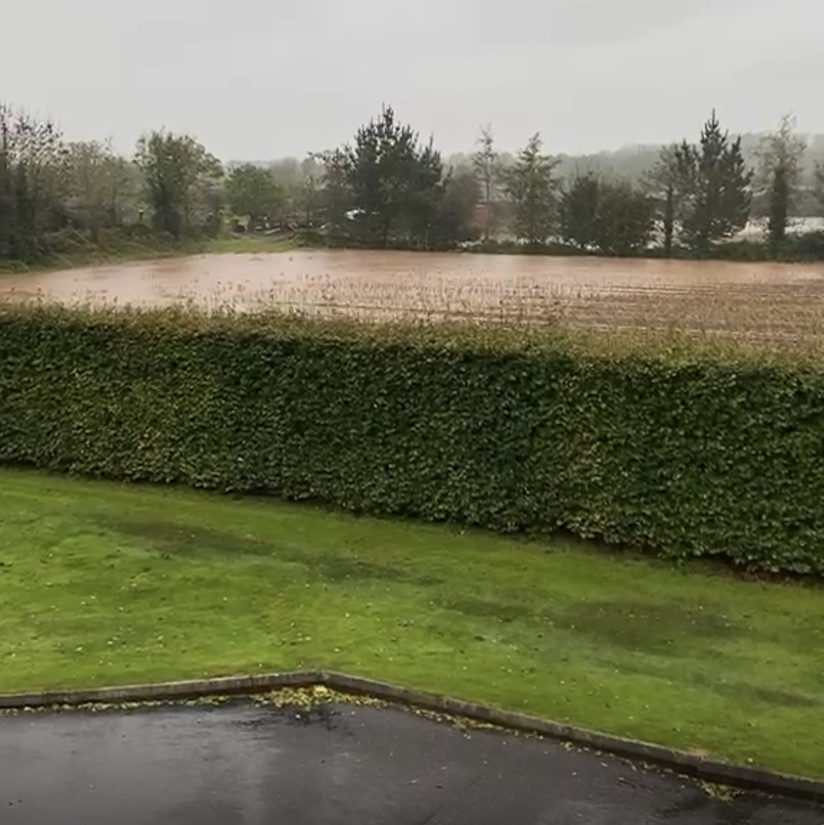
Cork County Council has prepared a Part 8 Planning Application for the Carrigtwohill to Midleton Inter-Urban Cycle Route Phase 2 (December 2023, prepared by WS Atkins Ireland Limited for Cork County Council). Phase 1 of the route received Part 8 Planning Approval from Cork County Council in 2022. Phase 2 — the section under planning — runs through agricultural land parallel to the Cork to Midleton Railway Line, through the Ballyrichard More area, crossing Castle Rock Avenue and connecting to the Water Rock UEA. This is the same agricultural corridor that Option 7 proposes to use for a new depot access road.

The cycleway was designed as a peaceful, traffic-free route through open farmland

The Part 8 report describes Phase 2 as:

"a high-quality, predominantly off-road cycling and walking facility that is approximately 3.7km long"

Source: Carrigtwohill to Midleton Inter-Urban Cycleway Phase 2 — Part 8 Planning Application Report [DOC-4], Section 4, page 31

"following an easterly direction through open agricultural lands"

Source: DOC-4, Section 2.4, page 16

The scheme's stated safety objective is:

"To maximise user safety by providing a traffic free route that is segregated from vehicles wherever practicable"

Source: DOC-4, Section 2.5, page 17

And its economy objective includes:

"To form part of a strategic network of scenic greenways and cycle routes, encouraging cycle tourism and boosting the local economy of towns and cities"

Source: DOC-4, Section 2.5, page 17

Option 7 would place a two-lane vehicular road — used 24 hours a day by HGVs and depot staff — through the same corridor that the cycleway was designed to pass through as a quiet, off-road amenity. A path alongside an active industrial access road is not the same amenity as a path through open farmland. The difference in user experience is like that between the Midleton–Mogeely Greenway and a footpath running alongside the road from Waterrock to Midleton.

The cycleway is backed by national and regional policy that Option 7 directly conflicts with

The Cork Metropolitan Area Transport Strategy 2040 (CMATS) describes Route IU-1 — of which this cycleway is a section — as:

"a fully segregated cycle track parallel to the rail line from Midleton to the west of Carrigtwohill village"

Source: DOC-4, Section 3.2.3, page 30

The Cork County Development Plan 2022 Objective TM12-2-1 mandates delivery of IU-1 as a high-quality pedestrian and cycle facility. The National Cycle Policy Framework requires active reduction of HGV volumes near cycling infrastructure. The Climate Action Plan 2023 identifies active travel corridors of exactly this kind as essential to meeting Ireland's transport emissions targets. Option 7 routes 24-hour depot HGV and staff traffic through a corridor that national and regional policy has designated as a traffic-free active travel amenity.

The cycleway involved proper public consultation and landowner engagement; Option 7 bypasses this through a Railway Order

Both phases of the cycleway went through the Part 8 process — public consultation, Cork County Council oversight, ecological assessment, and engagement with landowners. The Part 8 scheme objectives commit explicitly to:

"To embrace public input during the development and operational stages so as to enhance community ownership of the scheme"

Source: DOC-4, Section 2.5, page 17

"To minimise economic impact to landowners"

Source: DOC-4, Section 2.5, page 17

Landowners in this corridor agreed to the cycleway through a transparent planning process. Option 7 is being progressed via a Railway Order to An Coimisiún Pleanála, which bypasses Cork County Council entirely and overrides its planning decisions. The very authority that planned, funded, and approved the cycleway is required to comply with a Railway Order it had no part in designing. The routing of depot access traffic is being placed above a publicly funded amenity for the communities and tourists of East Cork, through a process that overrides the democratic planning decisions of the local authority.

Irish Rail's own OSR acknowledges the cycleway conflict — but proposes to resolve it by merging the cycleway into an HGV road

The OSR explicitly acknowledges that the depot severs the planned cycleway. In its assessment of the Existing Transport Network (Section 4.4.2), the report states, in relation to Options 1–4:

"As the depot severs the planned Interurban Cycle Route, a diversion of the cycle route is required."

Source: Depot Access Road Option Selection Report v04 [DOC-1], Section 4.4.2, page 32

For Options 7 and 8, the OSR claims this problem is resolved through "active travel integration." But the nature of that integration is described clearly in Section 3.5.2, which sets out what all Do-Something options consist of:

"The proposed options adopt a type 2 single carriageway with pedestrian and cycle infrastructure provided to cater for motorised and non-motorised road users while accommodating the heavy-duty vehicles and low-loaders necessary for the proposed depot operations. The adoption of this carriageway type also allows for active travel/greenway integration."

Source: DOC-1, Section 3.5.2, page 25

In other words, Irish Rail's solution to the cycleway conflict is to incorporate the cycle path as a footway alongside a two-lane carriageway built for HGVs and low-loaders. This is not the cycleway Cork County Council planned. The Part 8 cycleway application is explicit that its safety objective is a "traffic free route that is segregated from vehicles wherever practicable" through "open agricultural lands." A path on the verge of a depot access road is neither of those things.

The Irish Rail engineering drawing below — issued to affected landowners as part of this consultation — shows the reality of this proposal. The cycleway runs directly alongside the Option 7 depot access road: the same road that will carry HGVs and low-loaders 24 hours a day.

Irish Rail engineering drawing showing the cycleway running alongside the Option 7 depot access road
Irish Rail engineering drawing — issued to affected landowners

The proposed Option 7 depot access road (blue shading) with the cycleway running directly alongside it. This is Irish Rail's own drawing. The cycleway Cork County Council planned as a traffic-free route through open farmland would share a corridor with 24-hour HGV and low-loader traffic.

The OSR also cites Cork County Development Plan Objective MD-U-07 in support of Option 7 (Section 4.4.7, page 44). That objective requires that:

"Existing trees and hedgerows should be retained where possible with replacement planting proposed where retention is not possible."

Source: DOC-1, Section 4.4.7, page 44 — citing CCDP 2022 Objective MD-U-07

Option 7 requires the felling of the mature native trees and clearance of the hedgerows along this corridor. Irish Rail cites this objective as support for Option 7 while proposing works that directly contradict it.

In solidarity with our neighbours south of the tracks

Our neighbours on the south side of the railway line have waited many years for a pedestrian footbridge over the tracks — a crossing that would reconnect their community with ours. Cork County Council has already agreed in principle to this pedestrian overbridge, subject to certain terms being met.

We are concerned that the construction of the new depot and its associated works may push back the timeline for delivering this crossing further still. Our neighbours have already waited long enough. We call on Cork County Council and Iarnród Éireann to ensure that the existing commitment to this pedestrian overbridge is honoured, and that the CACR programme does not become a reason to further delay what has already been agreed.

A rail line should not be a permanent barrier between neighbours. Cork County Council has already committed to this crossing. We ask that this commitment be protected — not pushed aside — as the depot works proceed.

— Ballyrichard residents

Source Documents

All factual claims and quotations on this page are drawn from the following documents. These are the documents provided to the public as part of the CACR Phase 2 Public Consultation No. 2 (PC2), and one independent ecological report submitted to Cork County Council.

DOC-1

Depot Access Road Option Selection Report v04
Reference: C745-W05-P3-REP-CV-TRJV-00001
Prepared by: TYPSA / Roughan & O'Donovan for Iarnród Éireann
Issued as part of the CACR Phase 2 PC2 consultation documents.
Pages referenced in this document: pages 25–26 (Section 3.5.2, Do-Something options description and active travel/greenway integration), pages 32–36 (sections on Material Assets, Existing Transport Network), page 44 (Section 4.4.7, Zoned Land — CCDP Objective MD-U-07)

DOC-2

Depot Access Road Presentation
A 34-page presentation document prepared by TYPSA / Roughan & O'Donovan for Iarnród Éireann, issued as part of the CACR Phase 2 PC2 consultation materials.
This document contains the MCA scoring tables, option comparison slides, and direct text descriptions of each option's impacts on Noise & Vibration, Biodiversity, Material Assets and other criteria.
All MCA scores cited in this objection are drawn from this document.

DOC-3

LRD at Water-Rock, Midleton, Co. Cork — Ecological Impact Assessment
Reference: Woodrow APEM Report P00017150, V1 Final
Prepared by: APEM Group Woodrow (Jenny Kiely, Róisín NigFhloinn, Patrick Power, Sarah Brouder, André Robinson)
Commissioned by: HW Planning (5 Joyce House, Barrack Square, Ballincollig, Cork P31 KP84)
Date: 27 March 2026
Submitted in support of Planning Application for the Water-Rock Large Residential Development, Midleton, Co. Cork.
Surveys conducted: Preliminary Ecological Appraisal (April 2025); bat roost assessment (July, August, September 2025); nighttime bat walkover surveys (May, July, October 2025); static bat detector surveys (May–October 2025); breeding bird surveys (May–June 2025); wintering bird surveys (December 2024–March 2025).
Pages referenced: 19–43 (field survey results and assessment), 57–58 (Table 13, cumulative effects), 65–77 (Figures 1–13, site maps and bat activity maps).

DOC-4

Carrigtwohill to Midleton Inter-Urban Cycleway Phase 2 — Part 8 Planning Application Report
Reference: 5194601DG0224 Rev 1
Prepared by: WS Atkins Ireland Limited for Cork County Council
Date: December 2023
A Part 8 Planning Application for Phase 2 of the Carrigtwohill to Midleton Inter-Urban Cycle Route — approximately 3.7km running through agricultural lands parallel to the Cork to Midleton Railway Line from the Carrigtwohill UEA to the Water Rock UEA. Phase 1 received Part 8 Planning Approval from Cork County Council in 2022.
Sections referenced: Section 2.1 (Project Overview, page 7), Section 2.4 (Scheme Extents, page 16), Section 2.5 (Scheme Objectives, pages 17–18), Section 3.2.3 (CMATS, page 30), Section 4 (Description of Proposed Cycleway, pages 31–35).